Professional Wing Drone with RTK/PPK - DRONEE CORNETTE
Regular price
$2,749.00
Sale
More information at dronee.aero/rtk
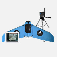
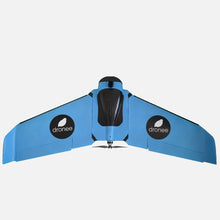
The Dronee CORNETTE is a full function mapping drone, weighing only 650 grams (22.9 oz), with a 90cm (35.4”) wingspan. Constructed using an EPP foam fuselage and carbon structure, it is both strong and lightweight. For the best image quality, the Dronee CORNETTE is capable of incredibly low speed flight, 13m/s.
Long Flight Time
Up to 55-minutes of flight time per battery. The charger can be connected to a 12V power supply, so you can charge the battery in your car in approximately 1-hour.
Coverage
Front overlap can be set for more than 95%. Using the Sony RX0 camera, with a side overlap of 70%, a resolution of 15cm/px (5.9”/px) can be achieved over a 540ha (1330ac) area in a single flight. The Dronee Plane can also accommodate the Sequoia Parrot camera, powered by an external USB port.
The Dronee App connects wirelessly, using the Wi Fi HUB base station via your tablet.
Key App Features
·3 modes of operation: Regular – orthomosaic position accuracy down to 2.5M (8.2’). Accurate – orthomosaic accuracy down to 50cm (19.6”). RTK/PPK uses the most advanced dual frequency, multi-GNSS system (L1/L2; E1/E5; B1/B5) with having orthomosaic accuracy down to 1cm+1ppm with RTK . Information is obtained from 5 satellite systems concurrently for the most accurate data.
- Input overlap requirements and drag the flight area, the app will do all other calculations for you.
- Automatic corridor mapping.
- Auto land with battery failsafe.
- Interface with Google Maps
- Geotag function.
- Compatible with KML and Shapefile.
·Geofence function allows you to enter maximum altitude and flight radius.
Ships in 7-10 business days
Package includes :
- DRONEE CORNETTE
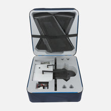
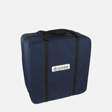
- Carrier case
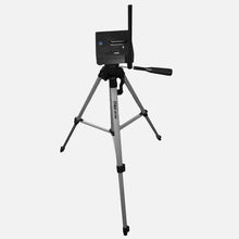
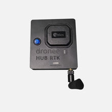
- HUB (wireless Base Station)
- 2 Li-Ion battery packs for plane
- 2 Spare Propeller
- Charger
- User manual
- Dronee App ( iOS app, Drone Control Software)
Technical Specifactions
| REGULAR | ACCURATE | RTK/PPK | |
|---|---|---|---|
| FLIGHT TIME | 55min | ||
| CRUISE SPEED | 13m/s (42fi/s) | ||
| WIND RESISTANCE | 13m/s (42fi/s) | ||
| WEIGHT | 650gr (22.9oz) | ||
| DETACHABLE WINGS | YES | ||
| WING SPAN | 90cm (35in) | ||
| LENGTH | 35cm (13.8in) | ||
| RADIO RANGE | 11km (6.8mi) | ||
| RADIO | 2.4GHz(LoRa) | ||
| RADIO POWER | +20dB | ||
| HUB ANTENNA GAIN | +5dBi | ||
| DRONE ANTENNA GAIN | +2dBi | ||
| EXTERNAL USB POWER | YES | ||
| DRONE BATTERIES | 2 | ||
| Concurrent GNSS | GPS/ GLONASS | GPS/ GALILEO/ GLONASS | GPS/ QZSS/ GLONASS/ BEIDOU |
| GPS BANDS | L1,B1 | L1,E1,B1 | L1/L2, E1/E5, B1/B2 |
| GPS ACCURACY | 2.5m (8.2ft) | 50cm (19.6in) | 1cm (0.4in) + 1ppm |
| RTK | NO | NO | YES |
| PPK | NO | NO | YES |
| PROPULSION | ELECTRIC MOTOR PROPELLER | ||
| BATTERY TYPE | 3-cells Li-Ion | ||
| POWER INDICATOR | SOFTWARE | ||
| POWER SUPPLY | 12V(9V-12.6V) | ||
| TEMP. RANGE | -15C/+40C | ||
| COMPATIBLE PROCESSING SOFTWARES | Pix4D,DroneDeploy, Agisoft Photoscan, Esri Drone 2 Map, Trimble Business Center, Bentley ContextCapture, Precisionmapper | ||
| Sony RX0 (21MP) | YES(OPTIONAL) | ||
| PARROT SEQUIOA (MULTISPECTRAL) | YES(OPTIONAL) | ||
| FLY/SURVEY CONTROL SOFWTARE | YES | ||
| CONTROL SOFWTARE COMPATIBLE DEVICE | iPad | ||
| GEOTAG SOFTWARE | YES | ||
| PPK SOFTWARE | NO | NO | YES |
| CARRIER CASE | YES | ||
| CARRIER CASE DIMENSIONS | 40cm x 40cm x 20cm (15.7in x 15.7in x 7.8in) | ||

Physical HUB RTK Size*
| WEIGHT | 350gr (12.3oz) | ||||
|---|---|---|---|---|---|
| WORK TIME | 20h | ||||
| CHARGE TIME | 5h | ||||
| WIDTH | 10cm (3.9in) | HEIGHT | 3cm (1.2in) | LENGTH | 9cm (3.5in) |
NOTE:Does not include antenna size!

Physical HUB Size*
| WEIGHT | 200gr (7oz) | ||||
|---|---|---|---|---|---|
| WORK TIME | 20h | ||||
| CHARGE TIME | 5h | ||||
| WIDTH | 10cm (3.9in) | HEIGHT | 3cm (1.2in) | LENGTH | 6cm (2.4in) |
NOTE:Does not include antenna size!

Avilable Onboard CAMERA Connectors
| USB | WiFi |
|---|


